Introduction-
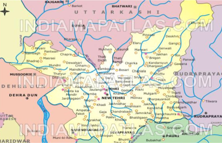
District TehriGarhwal is a part of Himalayan region, located in the middle of Uttarakhand as an eminent part of the state. TehriGarhwal district lies between 30º 3' 10" to 30º 5' 45" of North latitudes and 78º8' 45" to 79º2' 45" East longitudes. Approximately, this covers 4421 Square K.M. of area. It is contagious with Rudraprayag in the east, Dehradun in the west, Uttarkashi district in the north and district PauriGarhwal in the south respectively. This district has four famous routes of pilgrimage to Kedarnath, Badrinath, Yamnotri and Gangotri through it
Besides this, the district has some special feature in geographical point of view. The situation of TehriGarhwal in the middle of Himalaya provides it to become the land of glaciers, lakes and meadows which increase its natural beauty . Some eminent features are:
Glaciers-Khatling - The water source to river Bhilangana.
Lakes-Sahashratal- situated at 16780 'height in Budhakedar.
Meadows-Bugyal of Sahashratal and Mahasartal.KhatlingBugyal- AroundReeh near Ghutoo where the last village of the country Gangi is situated.
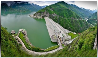
Tehri Dam -Geographical figure of Tehri is surrounded by the beautiful hill region, the flowing cooled water river like Bhilangana and Bhagirathi always remain the centre of attraction checking of its rivers it planned to make a dam over it. Construction of Tehri dam began in
1963. This great dam designed by Russian experts, is famous all over the world. This 260.5 mt. high dam is largest
rock filled dam in India, second in the Asia and fourth in the world.
Administrative Set Up
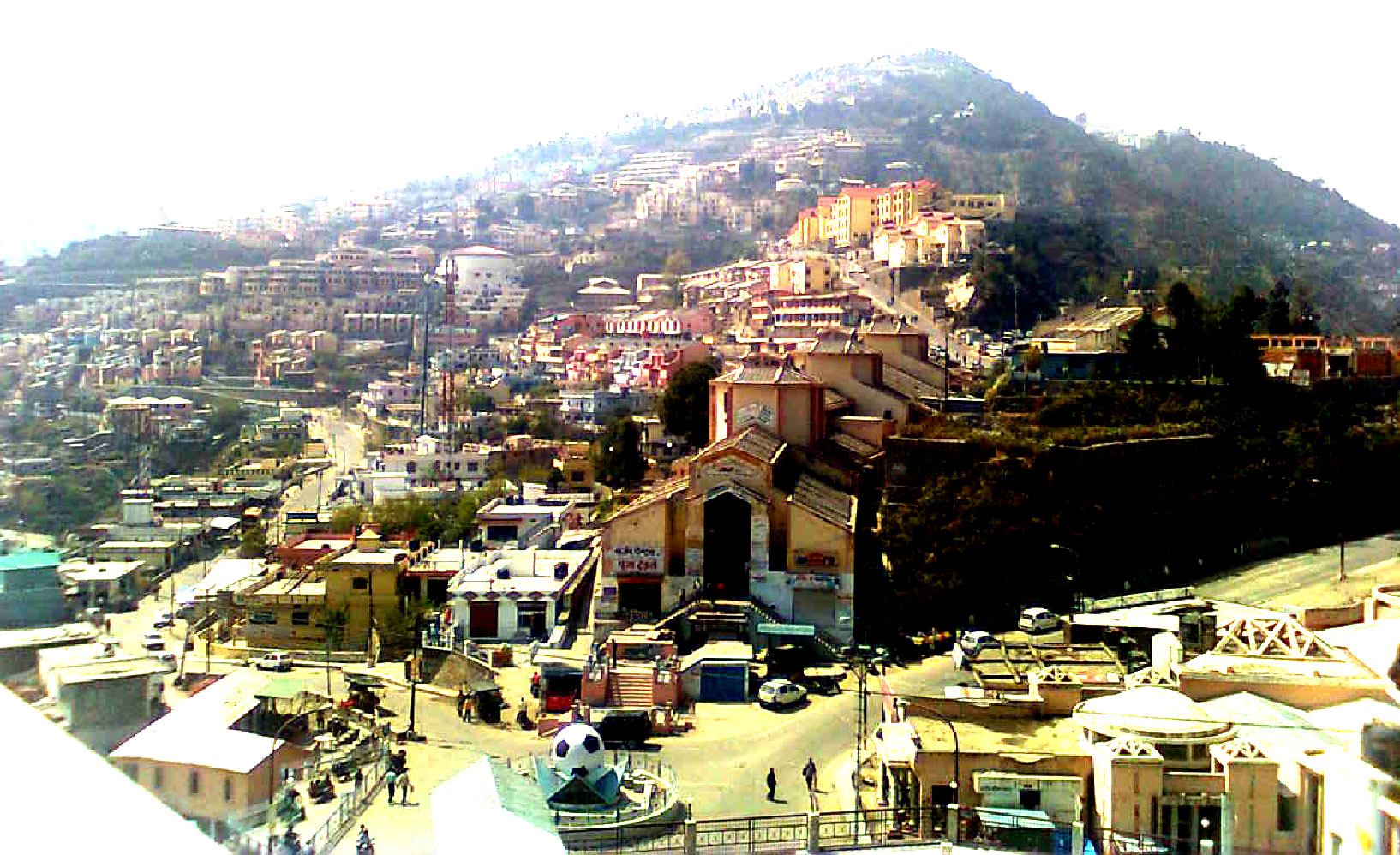
TehriGarhwal district with its head quarter at New Tehri is divided into several units and sub units for administrative point of view. The district has two sub divisions namely-Kirti Nagar and Tehri-Pratap Nagar. November 9, 2000 with the 13 district of the Himalayan region a New hill state of Uttarakhand came into existence on the map of India and thus Tehri Garhwal is a part of Uttarakhand now.
1-The district has TenTahsils- DevPrayag, Ghansali, Narendra Nagar, Pratap Nagar, Tehri, Jakhanidhar, Dhanolti,Nnainbagh&chham..
Besides these Tahsils there is only one sub Tahsil namely Gaja .
2- TehriGarhwal district is comprised with nine blocks- Bhilangana, Chamba, Deoprayag, Jakhanidhar, Jaunpur, Kirtinagar, Naredranagar, Pratapnagar and Thauldhar.
3- There are four municipalities- Tehri and Narendranagar, Chamba, and Muni Ki Reti.four-town area committees- Ghansali, Deoprayag, Kirtinagar and Lambgaon.
4- The district covers 75 Nyaya Panchayats and 979 Gram Panchayats.
5-The district has 1814 revenue villages and 2557 clusters.